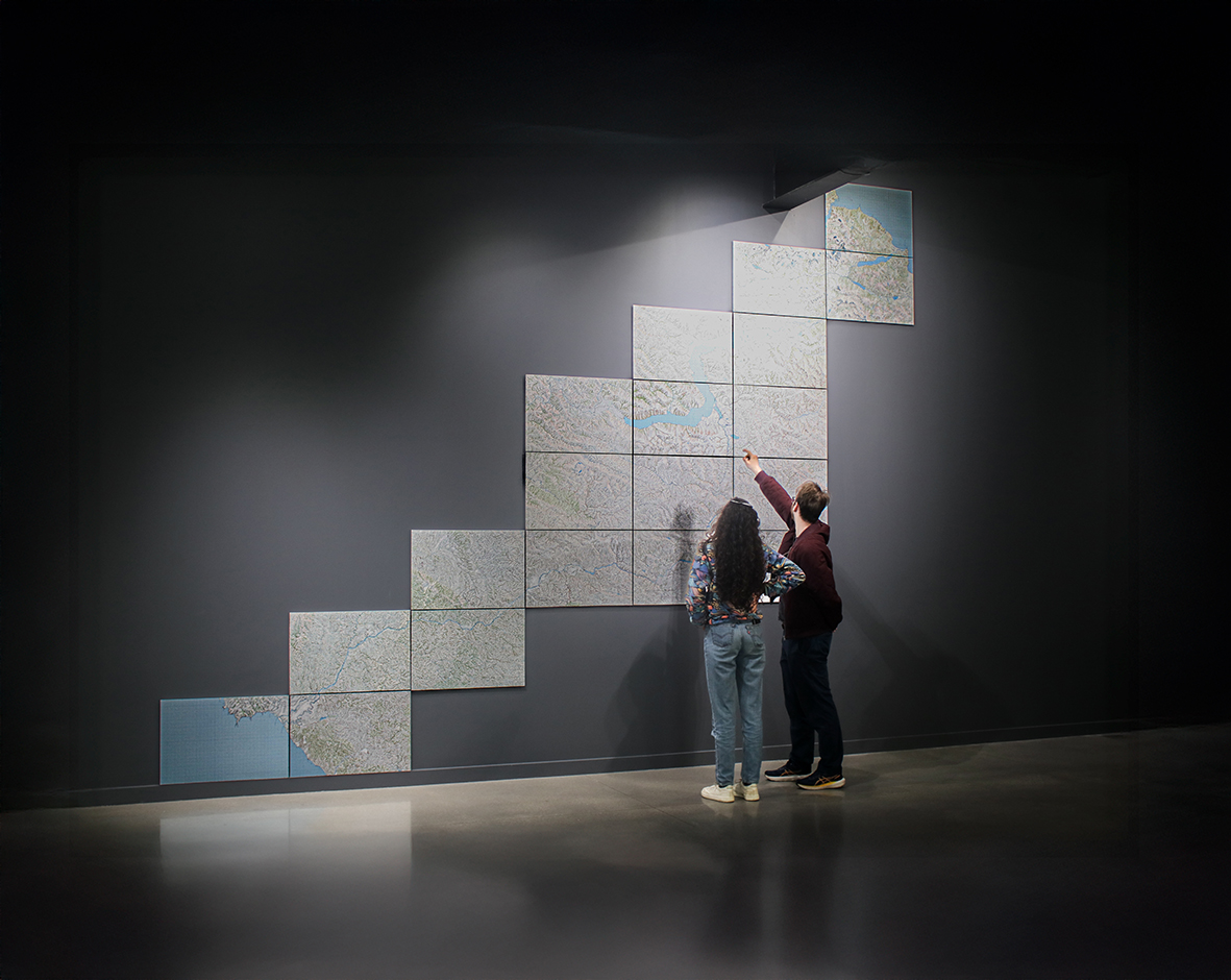
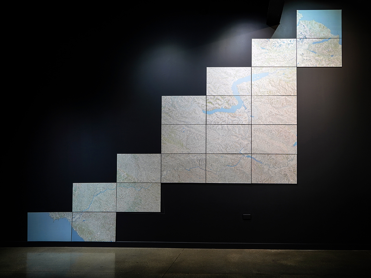
2025.TE ATAMIRA. QUEENSTOWN, NUEVA ZELANDA.
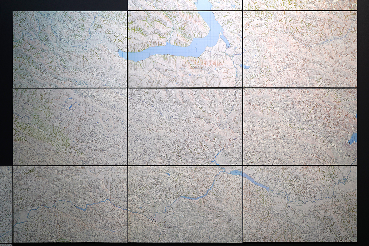
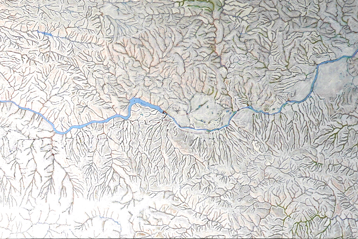
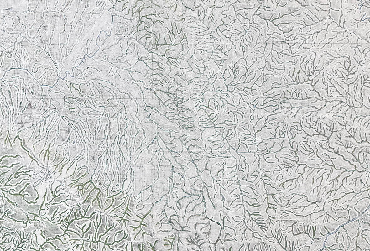
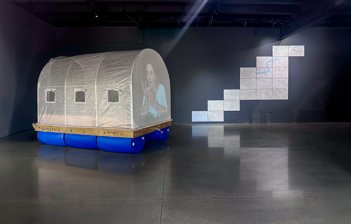
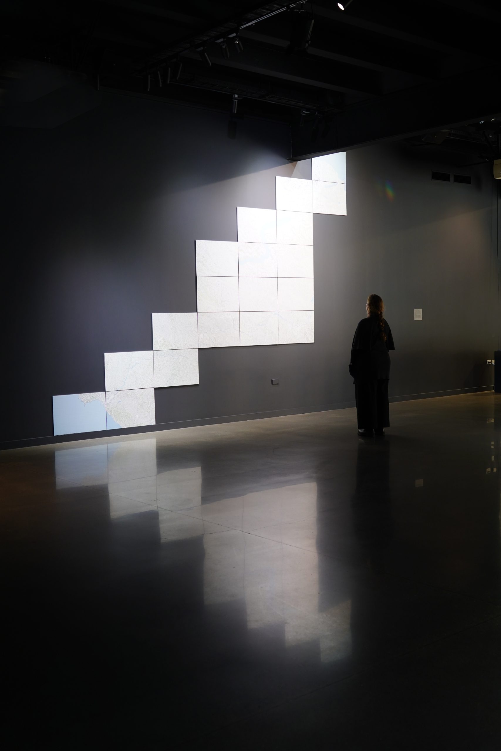
19 maps of Aotearoa intervened with correction fluid and white acrylic. In them, the artist covers the entire landmass—including cities, roads, and names—leaving visible only the bodies of water: rivers, lakes, glaciers, and the ocean. This gesture of erasing the solid to highlight the liquid transforms official cartography into a visible circulatory system, as if the nervous or rhizomatic system of the territory were being revealed.
The use of correction fluid, a material associated with error, censorship, or amendment, introduces a critical layer: what is usually invisible, yet essential, is concealed in order to be shown. The result is a ghostly geography in which water becomes the protagonist, revealing a network of life, memory, and connection that runs through the island.
These maps trace the course of water from Lake Wakatipu in Queenstown (the location of the gallery). The lake flows into the Kawarau River, which in turn feeds into the Clutha River, before finally reaching the South Pacific Ocean through an extensive fluvial network. This current suggests a possible poetic connection with other insular and continental territories.
———-
19 mapas de Aotearoa intervenidos con líquido corrector y acrílico blanco. En ellos, el artista cubre toda la masa terrestre —incluidas ciudades, carreteras y nombres—, dejando visibles únicamente los cuerpos de agua: ríos, lagos, glaciares y el océano. Este gesto de borrar lo sólido para resaltar lo líquido transforma la cartografía oficial en un sistema circulatorio visible, como si se revelara el sistema nervioso o rizomático del territorio.
El uso de líquido corrector, un material asociado al error, la censura o la enmienda, introduce una capa crítica: aquello que suele ser invisible, pero esencial, se oculta para poder ser mostrado. El resultado es una geografía fantasmagórica en la que el agua se convierte en protagonista, revelando una red de vida, memoria y conexión que atraviesa la isla.
Estos mapas presentan el curso del agua desde el lago Wakatipu, en Queenstown (ubicación de la galería). El lago fluye hacia el río Kawarau, que a su vez desemboca en el río Clutha, hasta finalmente alcanzar el océano Pacífico Sur a través de una extensa red fluvial. Esta corriente sugiere una posible conexión poética con otros territorios insulares y continentales.